By Shawn Parker
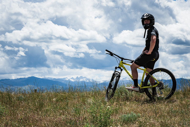
This week, we are biking some of Sheridan County’s best trails!
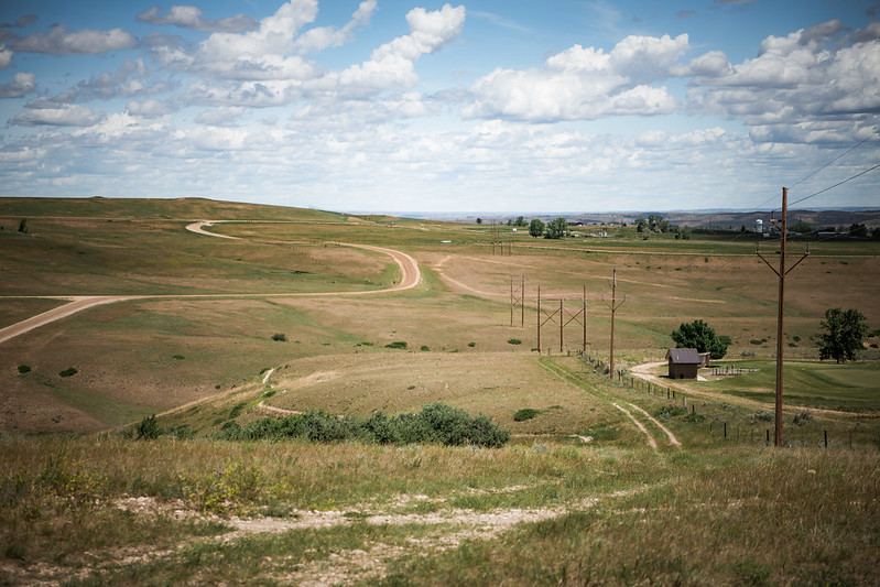
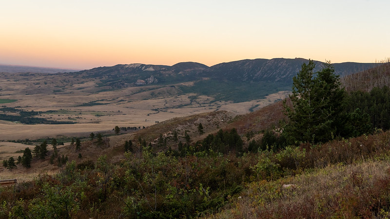
The City of Sheridan’s public pathways system includes roughly 20 miles of well-maintained walking and biking paths that connect to nearly all parts of the city. These paths connect to public parks, weave through our historic downtown, and lead to areas just outside of the city center, including Sheridan College, Sheridan County Airport, and much more. Many of the pathways offer stunning views of the Bighorn Mountains, creeks and streams, and a way for locals and visitors to get outside and enjoy one of Wyoming’s most scenic cities.
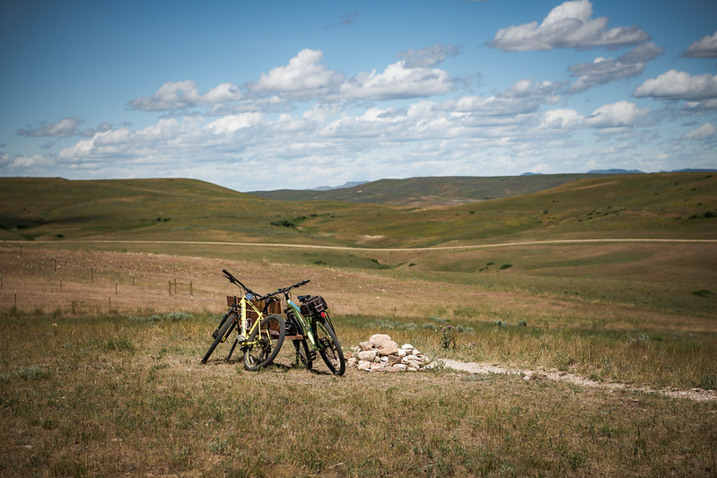
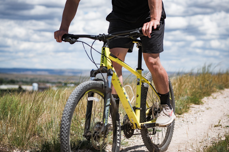
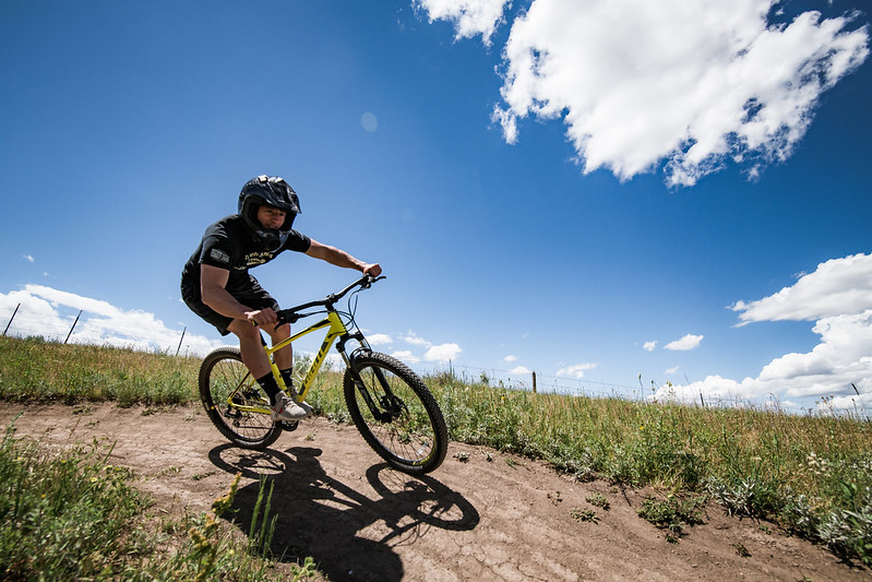
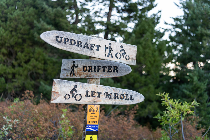
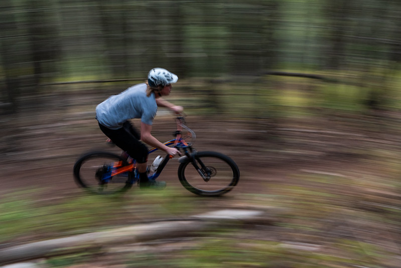
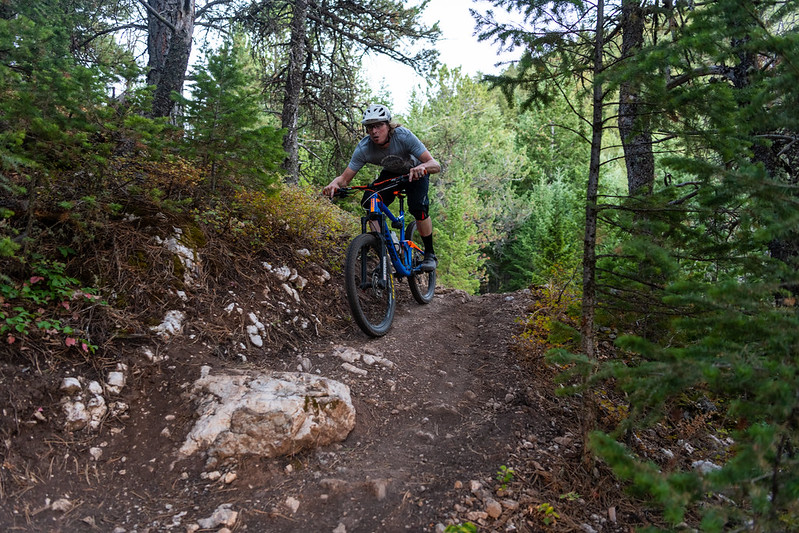
Our public pathways are also connected to some incredible trails, many designed and maintained by the great people at Sheridan Community Land Trust and Sheridan County. In this episode of The Backyard, we are riding dirty as we head out in search of adventure, with some help from our pals at Sheridan Bicycle Company.
Our wild ride begins at Kendrick Park, the city’s most popular public space. Named for cattleman and 9th Governor of Wyoming John B. Kendrick, the park features a band shell, playgrounds, an ice cream parlor, and the city’s bison and elk paddock. Just up the hill from the park is the Trail End State Historic Site, otherwise known as Kendrick Mansion, the governor’s former home.
The next stop is Malcolm Wallop Park, named for the former US Senator. Situated at the northern end of town, Malcolm Wallop Park is known for incredible views of the mountains, the serenity of Big Goose Creek, and remarkable fall colors.
The South Park Natural Area also offers up panoramic mountain views, as well as a chance to dip your toes into Little Goose Creek. South Park is a popular destination for photographers, bikers, hikers and walkers, and a great place to go for a stroll with the family.
This has been one of the wildest rides we have been on while filming The Backyard. So many miles of epic paths and trails that we had to call for backup to tackle some of the more technical terrain. There’s little doubt that Sheridan County is quickly becoming a destination for mountain bikers of all experience levels, and with organizations like the Sheridan Community Land Trust, Sheridan County and the City of Sheridan continuing to invest in the future of outdoor recreation, the experience is only poised to get better. Add in annual events like the Dead Swede, and there are sure to be many more miles to explore in the future. Until then, we will be out here chasing sunsets.
THE DETAILS
HOW TO GET THERE:
The City of Sheridan maintains a pathways map on its website. Click here to find a copy of a downloadable PDF. This is also where you will find the Pathways Master Plan, and information on any upcoming additions or improvements to the local system.
The Sheridan Community Land Trust has maps and information available on its website for Soldier Ridge Trail, The Link, Hidden Hoot, Red Grade Trails, and much more. Visit sheridanclt.org
Click here for the Sheridan Community Land Trust’s outstanding GIS map, with information on all of our local trails and pathways.
IMPORTANT INFORMATION:
Local trails are open year-round, but as the weather turns in the fall and winter, please use discretion when deciding to head out to recreate. Do not ride trails during or right after periods of rain or snow, as doing so can significantly damage the trails. The Sheridan Community Land Trust maintains an excellent public Facebook group on Sheridan Trail Conditions; during periods of inclement weather, have a look to see what people are saying about the trails. Click here.
ENJOY NATURAL PLACES RESPONSIBILITY
Sheridan County Travel & Tourism, the Wyoming Office of Tourism, the US Forest Service, Sheridan County, The City of Sheridan, and all our local communities hope you have a wonderful experience when you explore Wyoming. We want to encourage you to WY Responsibly, and wish to share these great tips. For more information, please click here.
Wyoming’s wide-open spaces make for epic camping and hiking. But before you set out, here are a few things to know.
Avoid overcrowding: Outdoor recreation is more popular than ever right now, causing overcrowding in some of Wyoming’s most beautiful areas. What do you do if you show up to a trail and the parking lot is packed? Instead of joining the crowd, know what other options are around. Be ready to seek different trails and lesser-known experiences. We have dozens of suggestions on our website.
Keep it clean: Almost half of Wyoming’s 98,000 square miles is publicly owned, including many undeveloped areas that have no bathrooms or garbage facilities. It is up to all of us to do our part in keeping these spaces clean. Take all trash with you when you leave, don’t burn glass and metal in your campfire and bury human waste at least 100 feet from water sources.
Be fire aware: Help prevent human-caused fires by following basic best practices. Respect fire bans in place, choose a campsite with a pre-existing fire ring whenever possible and never leave your fire unattended. Make sure you have plenty of water available to put out your fire; you’ll need to completely extinguish it at night and before you leave camp. And remember, there are strict guidelines on fires in the Cloud Peak Wilderness.
Stick to the trails: Ride, hike or drive only on designated trails to help reduce impacts and protect wildlife. Planning to do some off-roading? The state of Wyoming requires a permit to use trails and roads that are part of Wyoming’s State ORV program. You can find more information on trail etiquette in Wyoming here.
Respect Local History: Tread lightly and take only photographs with you when you leave. You will find ancient historic and ceremonial sites, Indian Wars Battle Sites, and many other iconic locations on your travels out here. Sites like the Medicine Wheel are still in use by native peoples; pictograph and rock art sites are extremely fragile, and should not be touched, defaced, or otherwise disturbed. We appreciate all of the wonderful folks who come to Wyoming to explore responsibly.
WILDERNESS REGULATIONS:
Note that professional filming is not allowed within the Cloud Peak Wilderness, and therefore, all the filming for The Backyard takes place outside of the wilderness boundary. Filming in the Bighorn National Forest is performed under a permit with the United States Forest Service. Please remember to practice good leave no trace principals, and leave the wilderness, as well as the forest, in the same condition you found it, so that those who come next may experience it the same way you did.
Click here for more information on wilderness regulations via the US Forest Service.
WHEN TO GO:
Sheridan County is a bustling community year-round, with many events, activities and attractions operating 12 months of the year.
GEAR UP:
Consider gearing up at one of our local shops or outfitters to keep Sheridan County’s outdoor industry thriving. Local outposts include Rocky Mountain Discount Sports, The Sports Stop, Sportsman’s Warehouse, Shipton’s, Tractor Supply Co., and Big Horn Trading. And don’t forget to visit Sheridan Bicycle Co. for your riding gear, resources, and local information, including trail conditions.
WHERE TO STAY:
Sheridan County has accommodations of every type to suit your Wyoming adventure dreams. Check out our online directory for information on hotels, motels, guest ranches, camp sites, RV parks, and more.
STAY INSPIRED:
For our full album of photos from this trip, visit our archive here.
For all of our short films, videos, and other film-related content, follow us on YouTube by clicking here.
STAY SAFE AND HEALTHY:
Currently, Sheridan County and the State of Wyoming are seeing a spike in the number of COVID-19 cases. To better protect residents from COVID-19, Sheridan County Public Health Officer Dr. Ian Hunter has issued a Public Health Order requiring that all adults within Sheridan County, Wyoming wear facial coverings in certain places open to the public, with some exceptions.
Click here to view Public Health Order 2020-5.
With the new order, minors over the age of 12 are now required to wear face coverings in the same manner as adults, and children ages 3 to 11 are encouraged to wear face coverings.
The health order will go into effect on Saturday, December 5 and remain in effect through January 8, 2021.
According to the Centers for Disease Control and Prevention (CDC) people infected with COVID-19 may not have symptoms, but they can still be contagious. Many individuals may only experience mild symptoms and do not recognize they are infected and contagious, and therefore can unintentionally infect others. Wearing a face cover helps prevent the spread of droplets that might be infectious. Wearing a face covering, when combined with physical distancing of at least 6 feet, staying home when sick, and frequent hand washing, can help minimize the spread of the virus that causes COVID-19.
COVID-19 Best Practices
The public is encouraged to follow these guidelines outlined by the Centers for Disease Control (CDC) and Wyoming Department of Health (WDH):
Avoid close contact (within 6 feet) with anyone outside of your household.
Wear cloth face coverings when out in the public.
Stay home if sick. (If you are concerned that the symptoms you are experiencing are outside of your normal everyday condition, please consult your physician.)
Avoid large gatherings.
Clean and disinfect frequently touched objects and surfaces using a regular household cleaning spray or wipe.
Wash your hands often with soap and water for at least 20 seconds. If soap and water are not available, use an alcohol-based hand sanitizer with at least 60% alcohol. Always wash hands with soap and water if hands are visibly dirty.
Please continue to be vigilant and practice all appropriate hygiene and distancing recommendations. Your hard work protects you, your family, and your community.
Observe Forest Service regulations when exploring the Bighorn National Forest. Bars and restaurants currently have limited seating indoors. Click here for up-to-date COVID-19 information and resources.