The Best Scenic Drives near Sheridan
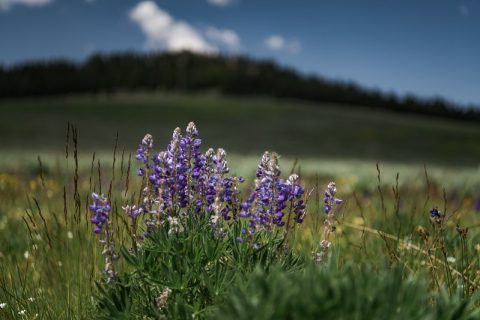
Northern Wyoming is renowned for its sweeping views of the dramatic, mountainous landscape that has captivated people around the world for decades. Dramatic golden plains, the snowcapped peaks of the Bighorn Mountains, and the remote beauty of the Cloud Peak Wilderness are all readily accessible from Sheridan, Wyoming. This guide will take you through some of the best scenic drives near Sheridan and into stunning landscapes unlike anywhere else in the world.
Bighorn Scenic Byway
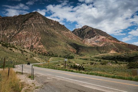
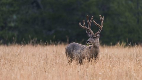
Bighorn Scenic Byway is the longest of the three national scenic byways in the Bighorn Mountains. The route begins in Dayton, Wyoming, takes drivers along Highway 14 through the Bighorn National Forest, ending in the town of Greybull. The 58 mile journey has many scenic stops along the way and allows for different activities, including camping, snowboarding & skiing, hiking, fishing, and plenty of wildlife viewing. The most popular stops include
Sand Turn Interpretive Site
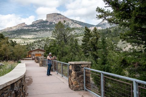
Sand Turn Interpretive Site is one of the last pulloffs before you enter the Bighorn Mountains—and it doesn’t disappoint. This is one of the most striking overlooks you’ll find in the entire region. From here, it feels like this incredible view of the Northern Wyoming flatland stretches on into infinity.
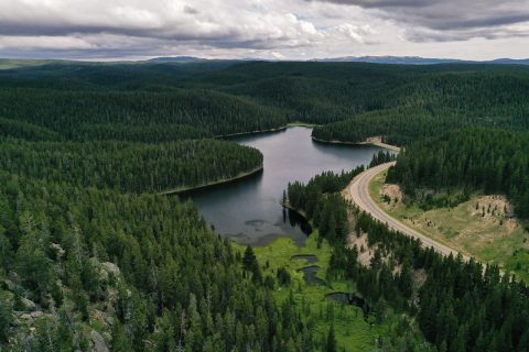
Sibley Lake
Stunning year-round and easily accessible, Sibley Lake makes for a perfect pulloff for hiking, snowshoeing, fishing, camping, and picnicking deep in the evergreen forest. Many of the trails are maintained regardless of season, while a dock extends along one portion of the lake. Keep an eye out for wildlife!
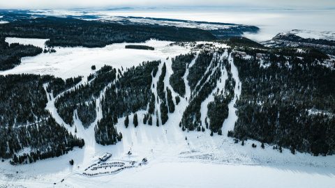
Antelope Butte
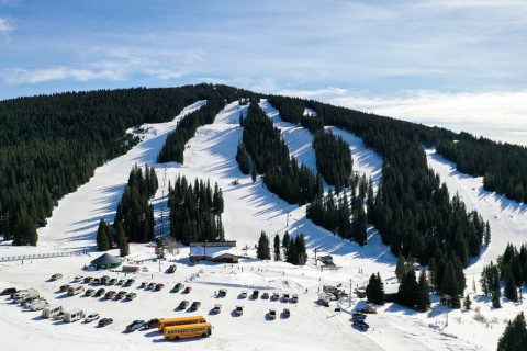
Located roughly halfway between Greybull and Dayton, Antelope Butte Mountain Recreation Area is a favorite spot for skiing and snowboarding. With affordably priced day passes, it’s an easy and worthwhile day trip. In addition to downhill skiing, the area also offers trails for nordic skiing and fat biking, making it a versatile winter recreation destination.
Shell Falls
Not far from Antelope Butte is a parking lot and interpretive site for Shell Falls, where you’ll quickly fall under the spell of the eponymous waterfall and cascading river. The site also features easily navigable walkways and paved trails that take visitors through the unbelievable views of the canyon.
NOTE: Shell Falls is currently closed for construction.
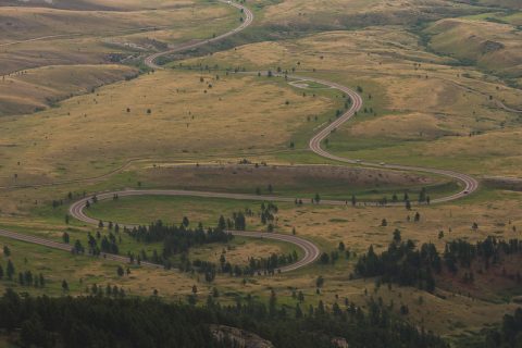
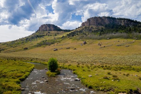
Cloud Peak Skyway Scenic Byway
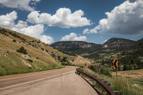
Located farther to the south, visitors can pass through Buffalo, Wyoming, and onto Highway 16 to enter the Cloud Peak Skyway Scenic Byway. The 47-mile-long route takes drivers past the tallest mountain in the Bighorns, the aptly named Cloud Peak, standing at 13,167 feet. This popular byway offers excellent panoramic views in several spots, including the Powder River Pass, where you’ll reach 9,666 feet.
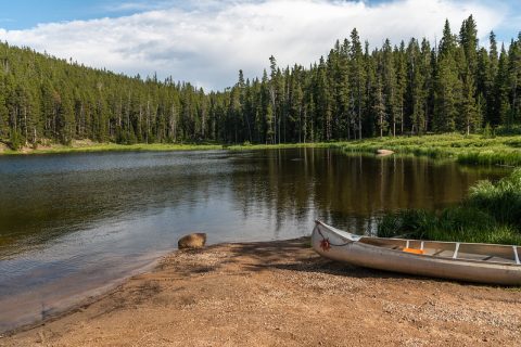
Meadowlark Lake
Meadowlark Lake is the most popular option along the byway for outdoor recreation of all kinds. Offering a campground and the beautiful Meadowlark Lake as a venue, boating, camping, fishing, hiking, ski trails, and much more are available here, including a commercial lodge.
James T. Saban Lookout
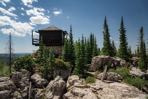
Visitors can access a stunning lookout just a short drive from Meadowlark Recreation Area. By following Forest Road 429 to an off-road parking area, you can then enjoy the short .6-mile hike to James T. Saban Lookout, formerly known as High Park Lookout. The tower is on the National Register of Historic Places and gives visitors one of the best panoramic views along the scenic byway.
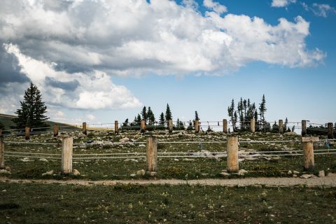
Powder River Pass
Likely the most popular point on the Cloud Peak Skyway Scenic Byway, the Powder River Pass is the highest point on the drive. Sitting above the treeline, the lookout allows visitors expansive views of dramatic alpine terrain, rolling valleys, and distant peaks.
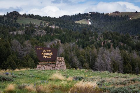
Medicine Wheel Passage Scenic Byway
Keep straight at Burgess Junction to enter the Medicine Wheel Passage Scenic Byway, accessible during the warmer months via the same road as the Bighorn Scenic Byway. The road is the northernmost route through Bighorn National Forest and offers the most unforgettable locations in all of the Bighorns—the Medicine Wheel National Historic Landmark and the National Forest Boundary.
NOTE: Medicine Wheel Passage Scenic Byway is closed during the winter.
Medicine Wheel National Historic Landmark
Far and away the most significant landmark in the Bighorns, the Medicine Wheel National Historic Landmark is a centuries-old, sacred Native American location found near the summit of Medicine Mountain. It is an important ceremonial site for many tribes, and ceremonies still take place today. The Medicine Wheel is accessible via a 3-mile round-trip hike.
Crystal Creek Overlook
The Medicine Wheel Passage Scenic Byway begins at the Crystal Creek Overlook, where visitors can pull off the main road and take in the vast, seemingly limitless views of the Bighorn Basin.
Bald Mountain City
Though actually Bald Mountain Overlook, this striking view was once the site of a gold rush town, Bald Mountain City. The rocks surrounding this overlook were discovered to hold trace amounts of gold. Prospectors flooded the area, only to discover over the next 10 years that the yields were not large enough to be worth the extensive labor involved.
North Tongue River
The North Tongue River and its many creeks wind alongside the Medicine Wheel Passage Scenic Byway. Pull-offs along the drive allow excellent photo opportunities and the chance to spot wildlife. Anglers flock to the river for the ample roadside access.